Hello! Just an idea by the way:
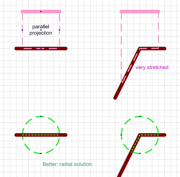
Most of the article relate to the application on a map. However, on particularly uneven surfaces, near cliffs or steep mountains, the projections are very misshapen.
How about a ball / radial solution?
The center of the sphere is the center of the marker. Since a map can never go straight up, we have no problem with gimbal lock. The projection lies like a tablecloth on the map.
I would be more beautiful.
Edit: something like this:
The red marking is a parallel projection 0, -1,0. You can see the stretching on steeper slopes.
The turquoise marking is the radial solution.
White occurs on flat planes when they overlap.

